MVF Visualizer
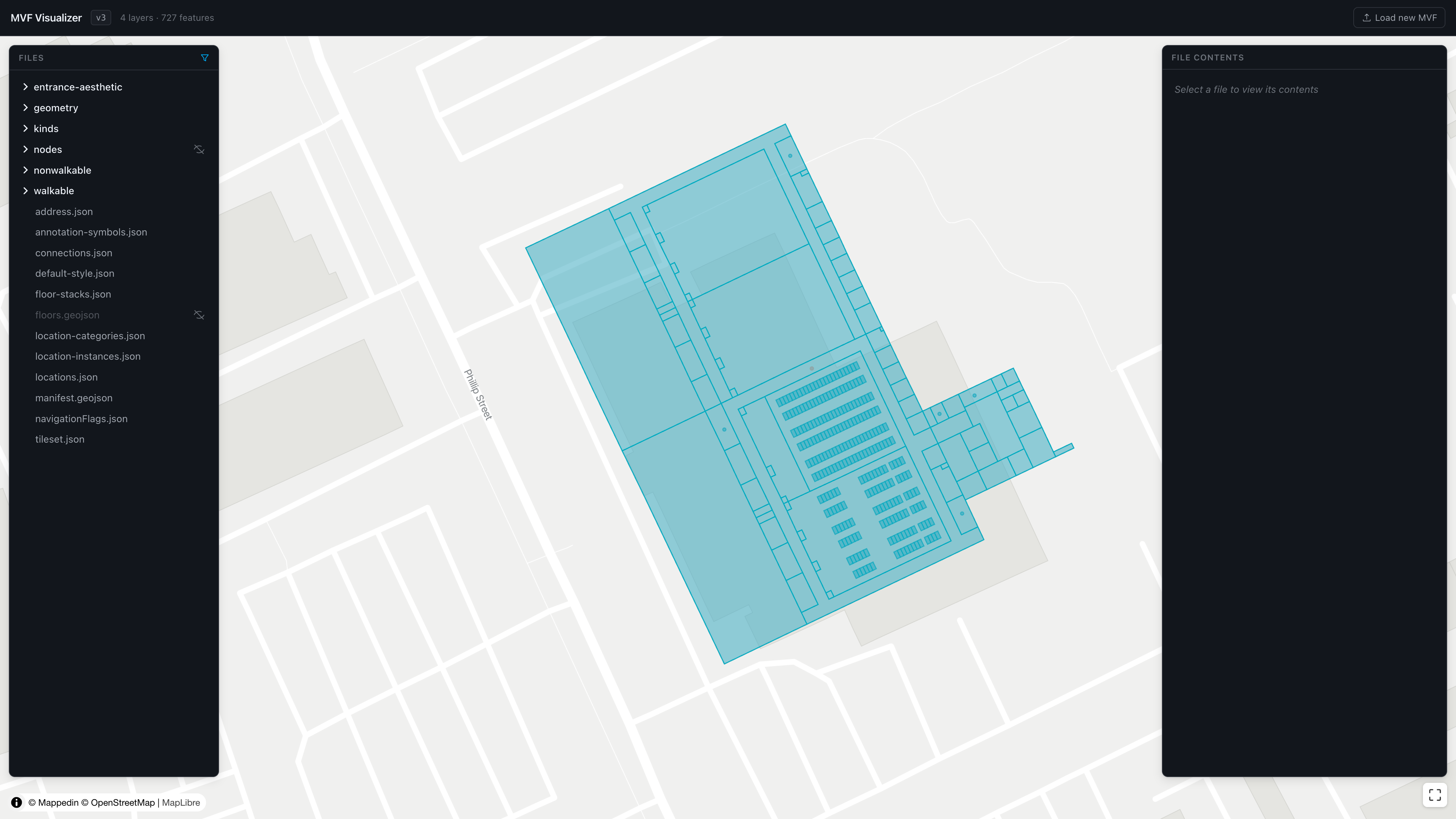
The MVF Visualizer renders a Mappedin Venue Format (MVF) bundle on a 2D map for inspection and debugging. Upload a zip file containing an MVF v2 or v3 bundle to browse its file structure, visualize GeoJSON layers on an outdoor base map, and inspect individual feature properties.
How To Use
- Open the MVF Visualizer.
- Drag and drop an MVF
.zipfile onto the upload area, or click Choose file to select one from the file system. - Once parsed, the map renders all GeoJSON layers and the interface displays the file tree, map view, and file contents panel.
Features
File Tree
The left panel displays the folder and file structure of the MVF bundle. Selecting a file highlights it and displays its JSON contents in the right panel. GeoJSON files include a visibility toggle (eye icon) to show or hide their layer on the map.
Map View
The center panel renders all visible GeoJSON layers on a 2D base map. The map automatically fits to the bounds of the loaded data. Click the re-center button in the bottom-right corner to reset the view at any time.
Clicking a feature on the map opens a popup displaying the feature's properties, including its source file and any cross-referenced IDs. Cross-reference links navigate directly to the related feature.
Floor Filter
For multi-floor venues, use the floor filter control to show or hide layers by floor.
Edge Weights
Node layers support an edge weight visualization toggle that overlays connection weights on the map for debugging navigation graphs.
File Contents
The right panel displays the raw JSON contents of the selected file with syntax highlighting and search functionality.
Notes
-
All processing occurs in the browser. No data is uploaded to a server.
-
The visualizer supports both MVF v2 and MVF v3 bundles.
-
The bundle is cached locally so it persists across page refreshes. Click Load new MVF in the header to clear the current bundle and upload a new one.